
Superior Neighbor Records by Source
A block search should answer a place question before a people question. Superior and Douglas County sources describe parcel outlines, assessment snapshots, district boundaries, public works, and historical addresses. Each has a limited purpose. None is a complete, current list of everyone near an address.
| Source | What it shows about a block | Access |
|---|---|---|
| Beacon GIS | Parcel shapes, adjacent parcels, mapped features | Public web viewer; dynamic fields may vary |
| Assessordata | Tax key, situs address, assessment and owner label | Free county and address search |
| City Map Gallery | Voting, zoning, school, and road context | Public city maps |
| City Archive | Dated projects, minutes, planning and public works references | Keyword and date search |
| Historical collections | Plats, deeds, abstracts, directories, and old block context | Library, society, or custodian request |
The assessment owner may live elsewhere, and a renter or other household member may not appear. A parcel can be vacant or owned by a trust, estate, or organization. Treat an owner field as a property fact, not a resident claim.
Map a Superior Block Outward
The Douglas County and City of Superior Beacon GIS is the geographic starting point. City documentation confirms search, viewing, measuring, printing, parcel maps, and property information. The live viewer’s precise field and layer labels were not captured, so record only what the current interface actually displays.
- Search a known address and confirm the selected parcel polygon.
- Write down its tax key, street frontage, cross streets, and map date.
- Inspect polygons touching it, retaining parcel identifiers instead of publishing a row of names.
- Compare zoning, roads, school, and voting layers when those layers are present.
- Use the assessor or deed route only for a specific parcel that needs a documented check.
This address → parcel → adjacent polygons → public layers flow keeps the research focused on place. For a complete chain along one road, switch to the Superior street directory rather than stretching a block search into a citywide list.
Map carefully. Beacon is for orientation, not a legal survey. Wisconsin requires a licensed surveyor when an official boundary determination is needed.
Superior Address Points Are Not People
The city’s Transportation and Addressing information describes the address-point layer as a public-safety and planning tool. Emergency dispatch, law enforcement, and land-use work all depend on consistent points. That makes the layer strong evidence for an address object, but weak evidence for the identity of Superior neighbors.
City Public Works assigns addresses inside Superior. County Zoning handles incorporated villages and unincorporated Douglas County, while the Real Property Lister checks improvements with addresses. This split matters near municipal edges. A postal label, city line, parcel, and ZIP can point to different geographic ideas.
No official street-renumbering list was found. When an old directory and current map disagree, preserve the old number and search dated plats, council minutes, archive records, and Public Works material. Do not invent a renumbering event.
Superior Neighborhood Labels Need Sources
Neighborhood names are source-dependent. The ConnectSuperior project refers to University and North End in a community-infrastructure setting. A city historical survey supplies Central Park context. Those are useful planning and history labels, but they do not prove that a formal association speaks for every person in the area.
The Superior Map Gallery offers councilor, county supervisor, zoning, school, and road maps. A voting district is an election unit. A ZIP is postal. A parcel is a mapped legal or tax unit. A block is defined by roads and parcels. Keep those layers separate even when their labels overlap.
The 2019 survey names historical examples on East 2nd, East 4th, East 5th, East 7th, East 8th, and North 16th. These are sound test points for place-history research. They are not a current roster of Superior neighbors.
Note: A local name can be historically useful without being an official neighborhood or membership boundary.
Superior Civic Directory Leads
No official citywide neighborhood-association directory was located. The Superior-Douglas County Chamber directory has a Family, Community & Civic Organizations category, along with Religious Organizations and Government, Education & Individuals. It can supply outreach leads, but membership is voluntary and listings may age. It is not a government neighbor roll.
The captured Chamber directory shows the kind of category-led search available for Superior community contacts.
Open the Superior-Douglas County Chamber directory before using the captured view below.
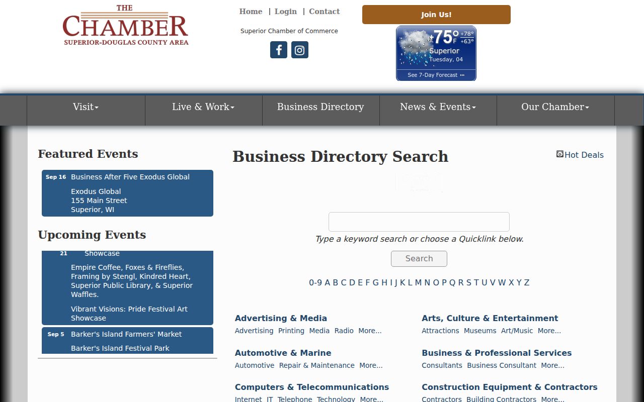
The screenshot helps locate the directory controls and categories. Verify a group’s current status with the organization before treating it as active or geographically representative.
Chamber Directory
205 Belknap St
715-394-7716
chamber@superiorchamber.org
City Clerk
1316 N 14th St, Suite 200
715-395-7200
City records and civic requests
GIS Help
715-395-7423
GISHelp@ci.superior.wi.us
Map and layer questions
Superior Neighbor Voting Context
MyVote Wisconsin is designed for a voter to check their own registration, elections, absentee tools, and elected officials using first name, last name, and date of birth. It is not a reverse-address directory. A separate public-data route begins with the Wisconsin Elections Commission voter-data page.
Wis. Stat. §6.36 governs registration-list access. The public field concept can include name, residence or mailing address, registration status, ward or precinct, districts, registration date, and voting history. Wisconsin does not register party affiliation, so no party field should be inferred. Birth dates, driver-license and Social Security numbers, certain identification-linked addresses, and Safe at Home data are protected.
For a block, use election maps to identify the district and elected office. Do not publish a voter-by-voter neighbor list. The City Clerk and Douglas County Clerk are the right contacts when the district or custodian is unclear, and current voter-data fees should be checked before any formal request.
Trace a Superior Block Through Time
Historical block research can add context without claiming who lives there now. Douglas County Historical Society collection leads include atlas and plat books in Box 25, deeds and abstracts in Box 79, city material in Box 80, and Public Works records in Boxes 88 and 207. A plat is a recorded drawing of lots, streets, and related boundaries.
The Superior City Archive can search category, keyword, archive, time period, and dates. Try a street name, cross street, park, public improvement, or planning term. Council, Planning and Zoning, and Public Works records may explain a road project or boundary change.
A defensible block record keeps the subject address, parcel key, cross streets, adjacent parcel IDs, road or water feature, zoning, map date, directory years, archive references, and public project. If an old and new number appear related, label that as an inference until a dated plat, directory cross-reference, or official archive entry confirms it.
Official Superior Records Beat Profiles
Commercial neighbor tools merge public and marketing data into identity profiles. They can be stale, attach the wrong person to an address, and hide source dates. Official records are narrower, but their custodians define what each field means. That makes a parcel key or archive date easier to verify.
| Approach | Strength | Limit |
|---|---|---|
| Official parcel and map records | Named custodian, parcel keys, dated layers | Owner is not necessarily occupant |
| City archive and historic sources | Dated civic and place context | Historical mention is not current residence |
| Commercial compiled profiles | Broad category search | Matching and freshness may be unclear |
For Superior neighbors, retain the original URL, field matched, record date, and checked date. If two official sources disagree, mark the conflict rather than averaging or forcing a person match.
Protect Privacy in Superior Neighbor Lookups
Wisconsin Safe at Home protects participating confidential electors and uses an assigned address. Juvenile, adoption, victim or witness, medical, financial, and sealed information can also be restricted. Utility and delivery records are not a public household directory. A missing name is never permission to work around a safety program.
Use Superior neighbor records to understand parcels, civic projects, community groups, family history, and personal safety. Contact the correct custodian to correct an inaccurate public field. A correction request should identify the source URL, record number, disputed field, supporting evidence, and a safe reply method.
Lawful use. Do not use a block lookup to watch, threaten, harass, or harm anyone, and never publish protected address information.
The best neighbor unit is often the parcel polygon. It can show adjacent parcel IDs, public infrastructure, zoning, and streets without exposing a mass list of private names. That balance keeps the result useful and grounded in what Superior sources actually prove.